What Is the Lhasa to Kathmandu Overland Journey?
The 900km overland journey from Lhasa to Kathmandu is one of the world's greatest road trips — across the Tibetan Plateau, past Everest, over 5,000m passes, and down into Nepal's lush valleys.
Known locally as the Friendship Highway (G318 / China National Highway 318), this route has linked Tibet with the Indian subcontinent for centuries as an ancient trade and pilgrimage trail, and today it carries travelers between two of Asia's most spiritually rich capitals. In roughly 7-10 days you cross the roof of the world, drive within sight of Everest's north face, and descend from barren 5,000m passes into the green, terraced hills of the middle Himalaya. It is both a logistical crossing and a slow-motion lesson in how radically landscape, culture, and climate can change within a single day's drive.
The Route, Stop by Stop
Lhasa → Yamdrok Lake (one of Tibet's three sacred lakes) → Gyantse (Pelkor Chode Monastery) → Shigatse (Tashilhunpo Monastery, seat of the Panchen Lama) → Shegar → Everest Base Camp (north face) → Gyirong Border → Kathmandu.
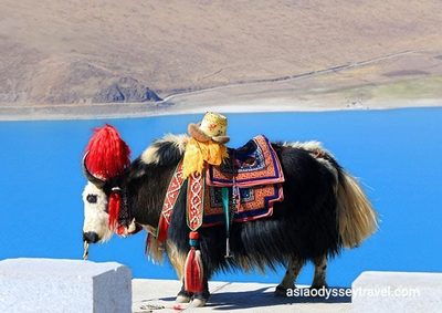
The journey naturally breaks into three acts. Act one, Tibet's sacred heart: from Lhasa you climb over Kamba La pass (4,794m) for the first of many unforgettable viewpoints, looking down on the turquoise coils of Yamdrok Lake. Continue to Gyantse, with its famous Kumbum stupa at Pelkor Chode, and on to Shigatse, Tibet's second city and the seat of the Panchen Lama at Tashilhunpo Monastery. Act two, the high plateau: from Shigatse the road runs west along the Yarlung Tsangpo valley to Shegar (New Tingri), the traditional staging point for Everest expeditions, before crossing Gyatso La (5,248m) — the "pass of the lakes" — and dropping to the Rongbuk / north base camp area. Act three, the Himalayan descent: return to Shegar and continue west to the Gyirong border crossing (Rasuwa Gadhi), then drop dramatically into Nepal's Langtang region and the Kathmandu Valley.
Everest Base Camp (North Side)
Unlike Nepal's trek-in EBC, the Tibetan side is accessible by road. From Rongbuk Monastery (the highest monastery on Earth), Everest's north face fills the entire sky. Stay in the tent camp and watch alpenglow paint the mountain pink at sunset.
Rongbuk Monastery, rebuilt after years of decline, sits at around 4,980m and is the traditional starting point for north-face expeditions. Spend an afternoon walking the moraine toward the base camp markers, then return to your heated tent camp. Dawn and dusk are magic hours here: the peak, often hidden in cloud by midday, glows gold and rose in the first and last light. Even if you have no intention of climbing, standing here — where Mallory and Irvine began their final ascent — is a pilgrimage in itself. Read more in our first-timer's guide to the Tibetan EBC.
The Himalayan Descent into Nepal
After the Tibetan Plateau's stark beauty, crossing into Nepal is a sensory explosion — from thin air and barren peaks to lush forests, rushing rivers, and terraced hillsides in just a few hours. The final descent into the Kathmandu Valley through terraced farmland and villages is pure joy.
The shift is the trip's signature moment. At the border you are still on an arid, high-altitude Tibetan plateau; within a few dozen winding kilometers you are among pine and rhododendron forest, waterfalls, and stone Nepali villages growing rice and millet. You pass through Syabrubesi and the edge of Langtang National Park before the road broadens into the Kathmandu Valley — a landscape of pagoda temples, terracotta rooftops, and bustling market towns. If you have the time, pause in Bhaktapur or Patan before reaching Kathmandu; both are UNESCO-listed Newar city-states that reward a slow evening.
Practical Logistics & Border Crossing
This overland crossing is not a self-drive road trip for foreigners. Both the Tibetan restricted zones and the China-Nepal border belt require permits, and independent travel in Tibet is not permitted — your vehicle, driver, and guide are arranged through a licensed operator. Plan on the following:
- Permits: a Tibet Travel Permit plus the border-area permit for the Everest / Gyirong belt; your Nepali visa is arranged separately (on arrival or in advance, depending on your nationality).
- Border crossing: the Gyirong / Rasuwagadhi crossing is the current main road link; allow a full morning for Chinese and Nepali immigration and luggage checks.
- Road time: budget 7-10 days for comfort. Rush it in 4-5 days and you lose the monasteries, lakes, and Everest stop that justify the journey.
- Altitude: you spend several nights above 4,000m before descending — keep to the acclimatization rules (hydrate, go slow, avoid alcohol early on).
For the health side of the high plateau, see Lhasa altitude guidance; for paperwork, the Tibet permit guide. Once in Nepal, extend into Kathmandu's temples and Himalayan viewpoints.
Best Time to Drive the Friendship Highway
The road is most enjoyable in the same windows that give you clear mountain views: April to early June and mid-September to November. Spring offers melting snows, greening valleys, and the best odds on Everest; autumn delivers washed-clean air and ripening barley fields. The monsoon (July-August) brings rain to the Nepali side, occasional landslides, and cloud-shrouded peaks — still passable with a patient driver, but less photogenic. Winter (December-February) is brilliant blue-sky cold on the plateau and crisp in Kathmandu, though high passes can be icy and border services slow.
What the Road Costs & How to Prepare
This is a long, remote drive, so a little preparation goes a long way. Expect full days in the vehicle (5-8 hours of road on the longer legs), with frequent stops for photography, tea, and checkpoint formalities. Pack layers, a warm hat, and sunglasses — the UV at 5,000m is intense, and the descent to Kathmandu swings from winter to summer in a day. Cash is useful in small towns and at the border; ATMs are reliable in Lhasa, Shigatse, and Kathmandu but scarce between them.
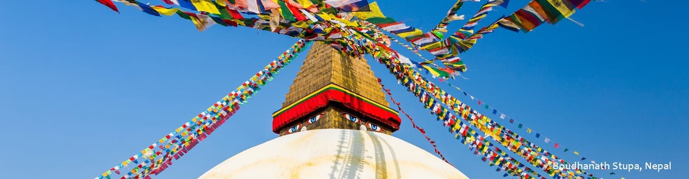
The crossing is a study in contrasts you will not forget: nomad tents and wild ass on the plateau, a chaos of prayer flags at the pass, then waterfalls and terraced rice fields within hours. Build in a buffer day on each end — a delayed border check or a long plateau afternoon is normal, and rushing ruins the rhythm of the journey.
Meals along the way are Tibetan and Nepali classics — momos, thukpa, dal bhat, and sweet tea — served at highway restaurants aimed at overland travelers. The further west you go, the simpler the menus become, so travelers with special diets should carry snacks. Your driver and guide know which stops serve the cleanest, hottest food, which is worth its weight on a long plateau day.
Frequently Asked Questions
How long does the Lhasa to Kathmandu overland trip take?
A comfortable crossing takes 7-10 days, allowing stops in Gyantse, Shigatse, Everest Base Camp, and the border. A rushed 4-5 day version exists but sacrifices the scenery that makes the Friendship Highway legendary.
Do I need a separate visa for Nepal if I cross by road?
Yes. Your Chinese visa and Tibet permit cover only the Tibetan side. You need a Nepal visa (available on arrival at the border or in advance depending on your passport). Your operator will advise current requirements.
Is the Friendship Highway road dangerous?
The road is paved and well-traveled, but it is high-altitude, remote, and subject to landslides in monsoon season. With an experienced local driver and a dry-season window, it is a routine and rewarding journey.
Can I do this route in winter?
Winter (November-February) is bitterly cold on the plateau and some high passes can be hazardous. The best windows are April-May and September-October, matching the Everest viewing season.
Two capitals, one plateau, and the world's highest mountain between them. Browse our Tibet itineraries and Nepal extensions, or contact us to build your own Lhasa-to-Kathmandu overland adventure.